University of Queensland (UQ) scientists are collaborating with some of Central Queensland’s largest miners to minimise the amount of sediment reaching the Great Barrier Reef from their operations.
As part of a project funded by the Australian Coal Association Research Program (ACARP), a multidisciplinary team from UQ’s Sustainable Minerals Institute (SMI) is cooperating with industry environmental teams to develop and validate technical guidelines that will improve erosion and sediment control management.
Sediment run-off into the Great Barrier Reef lagoon can result in a variety of harmful responses from seagrasses and coral communities which, if widespread, could alter coral reef structures.
Professor Claire Côte, Director of SMI’s Centre for Water in the Minerals Industry (CWiMI) said the project is an opportunity to generate new scientific knowledge.
“The quality of water entering the Great Barrier Reef lagoon over the past 170 years has declined significantly as the regional basins have been extensively modified for agriculture and urban settlement,” Professor Côte said.
“Managing sediment run-off is a key focus of the state government’s Queensland Reef Water Quality Program, and the world will be watching what Australia does to protect the Reef.
“Mining itself is a very small contributor to sediment run-off – it isn’t even captured by government modelling – but the industry decided to take a leadership position on the issue.
“Importantly, the tools and techniques we are developing will not just be useful in a mining context but can also be applied by sectors that are far larger sediment contributors, such as agriculture.”
The project, which is expected to run for two years, builds on an earlier ACARP-funded scoping project in which CWiMI reviewed the mining industry’s erosion and sediment control practices.
That project found industry’s practices complied with regulations but could be better documented and communicated through the adoption of a soil erosion model that has been proven to work on a larger scale.
The chosen model was originally designed for agricultural applications and is commonly used in construction sites, but has never been validated for mine sites.
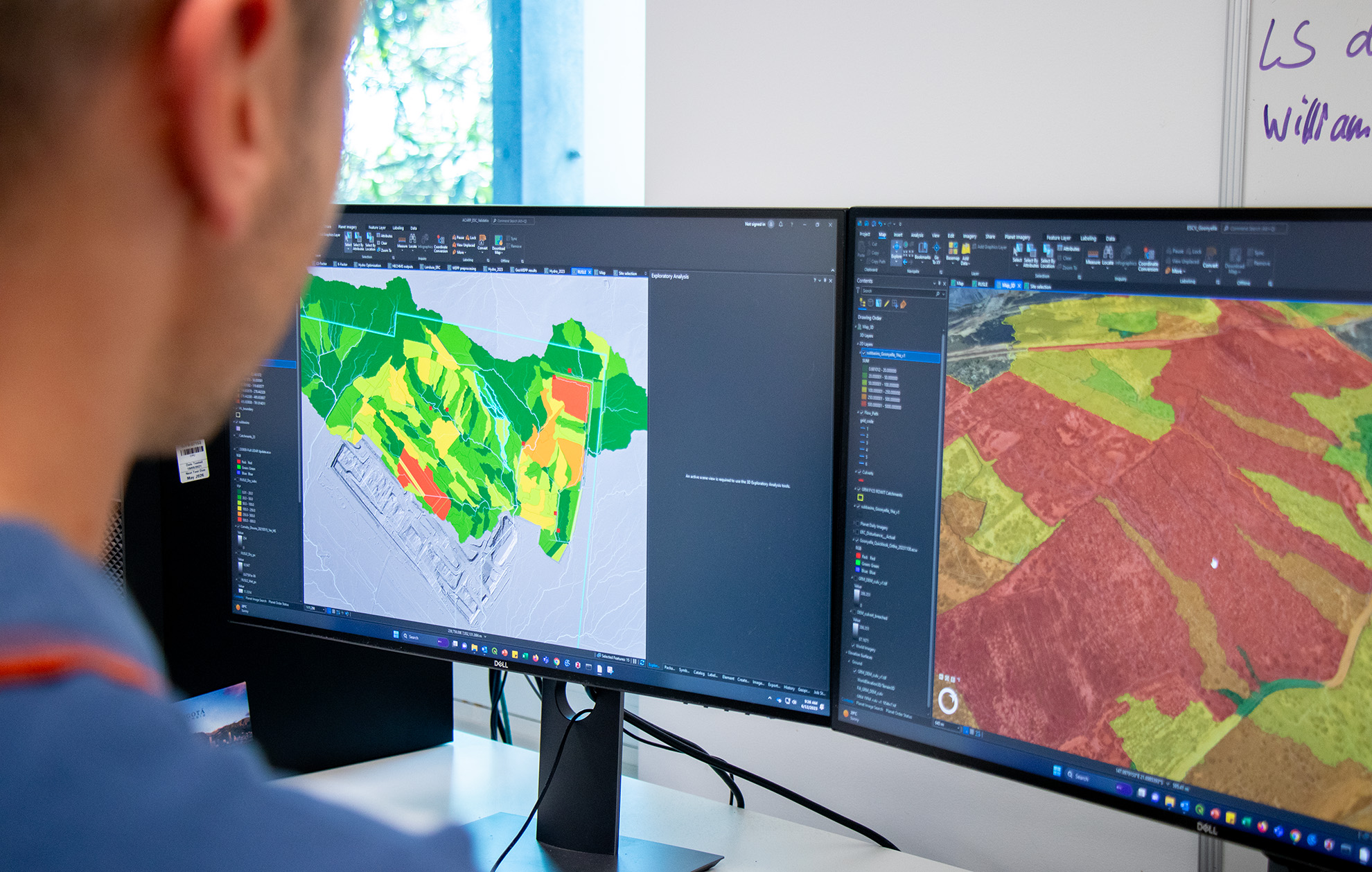
CWiMI’s Dr Robynne Chrystal said the proposal was well received and the next step would be to validate the model with on-site testing.
“Industry support is critical to this project because we need to collect data from sites,” Dr Chrystal said.
“Fortunately, local companies have been very supportive, with Yancoal, Anglo American, BHP and Glencore providing us with detailed data and access to their mines.”
“The next step will be to travel out to these sites and set up sediment traps to collect data that can be used to validate the modelling results”.
“Storm water will be collected in a basin and the quantity of sediment that collects at the bottom will be measured over a couple of months to better understand how quickly it accumulates.”
Parallel to this, Dr Pascal Bolz, a spatial scientist within CWiMI, contacted the US Department of Agriculture (USDA) to begin discussions about another model.
“Their model is different as it can clearly map and show the pathways through which sediments can end up in the environment, it goes beyond a risk assessment,” said Dr Bolz.
“We see great potential in using this as it has not been done in Australia yet.”
